
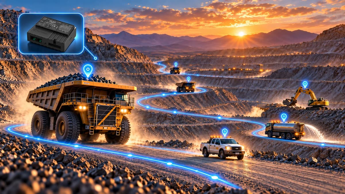
- GPS tracking
- Fleet monitoring
- Route management
- Operational alerts
- Reporting
Why does smart fleet tracking matter at a mine?
At mines, heavy machinery and support vehicles operate across different routes and zones at the same time. Without a centralized view of their locations and movement history, supervising the fleet and reviewing incidents is difficult.
A mine manager's main question is not only “Where is each machine?” but “Which machine is working within the permitted zone as planned, which has an unusual travel pattern, and where should we investigate?” Bitatracker turns scattered location data into a view that is easy to follow.
Common challenges
- Long stops
- Leaving designated routes
- Unauthorized speed
- No reviewable record of machinery movement
What problem does Bitatracker solve?
A centralized view instead of phone follow-ups
The last position and movement history in one place; day-to-day follow-up becomes organized, though it does not replace radio communication or operational safety instructions.
Event tracking and documentation
Recording the time and place of stops, zone crossings and route changes gives a basis for more precise conversations with contractors and shift supervisors; the degree of improvement depends on data quality and how the system is used.
Core capabilities of the Bitatracker system
The range of features depends on the settings and the data available from the equipment.
Map-based location tracking
Shows the last received position and whether the vehicle is moving or stopped; with an active connection and adequate coverage, information is updated continuously.
Route management and travel history
Review movement history, distance and time spent at different points; compare travel patterns and deviations from usual routes.
Geofencing
Monitor machinery entering and leaving operational zones, equipment parking areas and controlled areas.
Speed monitoring and operational alerts
Alerts for exceeding speed thresholds, long stops, and entering or leaving zones, based on the configured capabilities.
Operating hours and periodic service
A basis for planning technical inspections, oil changes and servicing; the accuracy of the operating-hours indicator depends on the tracker data and the machine.
Fleet reporting and analysis
Reports on location, route, distance, speed, stops and travel history; fuel consumption or technical parameters only with a compatible data source.
One dashboard for different mine roles
The mine manager needs an overview of the fleet; the shift supervisor focuses on events and routes within that period; the maintenance lead may review operating-hours history. Access levels and report layouts are designed to match user roles.
A displayed position can be interpreted only when the time of the last data reception is known. Network coverage, communication disruptions and installation location affect data delay; so “last recorded position” does not mean a guarantee of continuous connectivity.
Questions the dashboard answers
- Which vehicles had long stops during the last shift?
- Which equipment sent its last data later than the others?
- Has a vehicle entered or left a defined zone?
- What was a machine's movement history on a specific date?
How does the Bitatracker tracking system work?
- 1
Recording data on the machinery
The GPS tracker records position and supported movement and equipment status information.
- 2
Transferring data to the platform
Data is transmitted over the available network; some models temporarily retain information when the connection is lost and send it later.
- 3
Display and management review
Map, movement history, alerts and operational reports for managers and supervision teams.
Teltonika GPS devices for mining fleets
Tracker selection depends on environmental conditions, machine type, supply voltage, network coverage and the data required. Presenting these models does not constitute definitive confirmation of compatibility in every project.
An option for industrial environments
4G LTE Cat 1 connectivity and IP67 protection rating; worth considering for equipment exposed to dust and moisture.
Manufacturer specificationsTracking with diverse inputs
A 4G tracker with diverse inputs and connections for projects needing supplementary signals from compatible equipment.
Manufacturer specificationsFor heavy fleets and advanced applications
4G connectivity, external antennas and advanced interfaces; use of CAN or J1939 data depends on machine compatibility.
Manufacturer specificationsFor light and support vehicles
A compact 4G tracker for location and route tracking in light, service and support fleets at the mine.
Manufacturer specificationsTechnical note: The final model choice, available features and the device's connection to Bitatracker are determined after reviewing the machinery, communication coverage, installation method, protocols and a compatibility test.
Bitatracker use cases at a mine
For dump trucks, loading and service equipment, and maintenance, safety and support vehicles; the type of information for each group depends on the installed equipment and communication conditions.
Service vehicle traffic control
By defining the boundaries of the worksite, warehouse and workshop and reviewing route history, movements that need explanation can be identified.
Following haul fleet stops
A dump truck's recorded stops provide a basis for a conversation with the operator; determining the definitive cause usually requires cross-checking with other data.
Monitoring entry to defined areas
Entering and leaving a parking area or workshop is recorded as an event; its accuracy depends on GPS quality and correct boundary definition.
Reviewing contractor services
The traffic report is one supplementary document for evaluation, but on its own it is not a criterion for confirming operation volumes or progress payment statements.
What is the difference between Bitatracker and Bismart?
Bitatracker is not a replacement for Bismart dispatching; but with suitable infrastructure and integration, tracking data can be used in broader operational analysis.
BitaTracker
GPS tracking, location monitoring, travel routes, speed, stops, and fleet records and reports.
BiSmart
Mining fleet management and dispatching: the loading and haul cycle, equipment allocation, cycle time and bottlenecks.
Technical and infrastructure considerations before choosing a tracker
Communication coverage and environmental conditions
Checking network coverage at key points, routes and stopping areas; and the effect of dust, moisture, vibration and temperature on device selection and cabling.
Power supply and installation
Machine voltage, battery, constant power, safe wiring and antenna location; installation must not disrupt the machine's main systems.
Required data and compatibility
Location tracking needs differ from a project that requires operating hours, fuel or vehicle network data; the protocol and access permission are tested before commitment.
Security and data access
User roles, access management, retention procedures and backups, matched to the client's needs and the deployment architecture.
Bitatracker FAQ
Does Bitatracker only show location?
No. It also provides movement history, speed, geofences, operational alerts and fleet traffic reporting; the range of features depends on settings and data.
Does it work when the internet is down?
Real-time display requires an active connection. Some trackers store data temporarily and send it after reconnecting; this feature is checked for the selected model.
Is it suitable for heavy machinery?
Yes, with a tracker and installation method suited to the power supply, environmental conditions and technical needs of the machine. Receiving specialized data depends on equipment compatibility.
Is fuel consumption monitoring possible?
Yes, with a compatible sensor or data source and the necessary integration; GPS tracking alone does not measure fuel consumption.
Can existing trackers be used?
It depends on the model, transmission protocol, software features and legal and technical access to settings; a connection test is recommended before declaring compatibility.
Does Bitatracker connect to Bismart?
In projects where the need and infrastructure exist, data exchange is assessed for feasibility and the scope of the connection is defined in the technical design.
How is the deployment cost determined?
The number and type of machines, tracker model, accessories, installation conditions, network, modules, integration and support; an accurate estimate follows the needs assessment.

Your mine could be our next project
Our consultants are ready to answer every question on your path to a smarter mine.
Yazd, Motahari St., Eqbal Science & Technology Park, Al-Zahra Building, DIACO Mining Technology Development Center
Request an initial mine review
Three short steps — it takes less than a minute.
Step 1 of 3 · Contact details